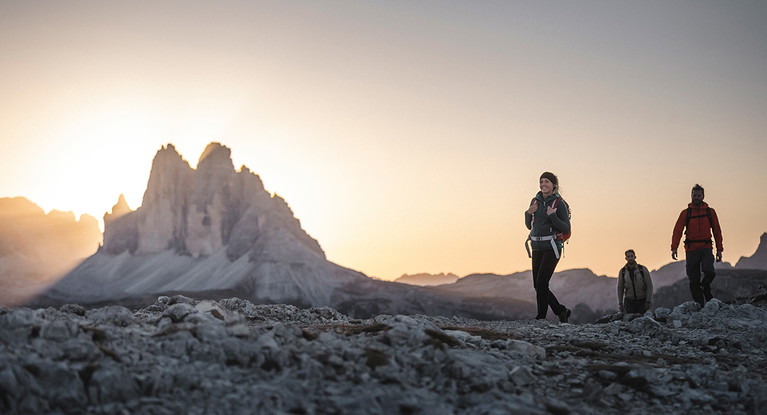
Skip to content
© IDM Südtirol-Alto Adige/Armin Terzer

The 3 Best Hiking Routes in South Tyrol

Experiences

Some of the most beautiful panoramas of the Alps make the hiking routes in South Tyrol unforgettable experiences - whether for beginners, advanced hikers or experts.

© IDM South Tyrol-Alto Adige/Thomas Grüner

Sexten route

Difficulty: easy
Suitable for: families with children or to relax between larger tours.

Without great differences in altitude, the circular trail offers exciting insights into the area around Sesto - and in addition magnificent panoramic views of the Sesto Valley. The starting and finishing point is the Sexten Tourist Office. Seven stations on the first section of the trail tell about the fauna of the valley as well as local myths and legends, the second section is about animal tracks, birds, mushrooms and plants. Highlight: Die „Sextner Sonnenuhr“ aus den fünf Dolomitengipfeln Neuner, Zehner (alias Rotwand), Elfer, Zwölfer und Einser, die vom Fischleintal die Abschätzung der Tageszeit nach Sonnenstand ermöglichen. Weiteres zu sehen, sind Überreste der im Ersten Weltkrieg umkämpften k.u.k.-Festung Heideck am Eingang des Fischleintals. Je nach Verweildauer an den umfangreich beschrifteten Stationen ist man zwischen drei und fünf Stunden unterwegs

Three Peaks Hike

© IDM South Tyrol-Alto Adige/Manuel Kottersteger

Difficulty: medium
Suitable for: hikers with sufficient lung volume for 950 meters of altitude.

Although the Three Peaks rise directly on the border with Belluno, their northern side is clearly on the territory of South Tyrol. The classic route runs from the Fischlein Valley (from the Fischleinboden parking lot) to the Talschluss Hut, surrounded by the Sextner Sundial, trail no. 102 leads through the Altensteintal Valley. Passing the foot of the Einserkofel, it goes up to the tree line; a stage that isn't suitable for long conversations, but delights with spicy mountain air. After about three hours you reach a plain with two lakes below the Paternkofel. Highlight: a short climb leads to the Three Peaks Hut, where a spectacular panoramic view awaits. The descent follows the same route.
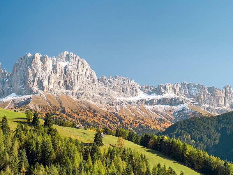
Rose Garden Trail

Difficulty: for expert hikers
Suitable for: sure-footed hikers in search of King Laurin.

The Kölner Hütte at 2337 meters is the starting and ending point for the five and a half hour hike around the probably most famous massif of the Dolomites. Over the Coronelle Pass (path 550) it goes to the highest point of the route at 2691 meters, over the Cigolade Pass (path 541) further to the Rotwand Hut. Highlight: at the foot of the needles of the Catinaccio, the Hirzelweg (549) leads back to the hut - one of the most beautiful hiking routes in South Tyrol.

Philipp Josef Rossmann
Author
Find out more
1 / 12