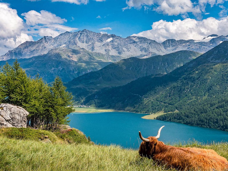
The connection with nature and the enjoyment of outdoor activities have increased significantly over the past twelve months. One hobby that can be perfectly combined with this is the Hiking. Especially hiking routes in alpine regions, where you are almost alone and turn inward while you can use a fantastic mountain scenery are becoming increasingly popular. Hiking also lowers stress levels and increases the production of happiness hormones such as serotonin. The immune system and metabolism also benefit from a trip to the Alps.
Here you will find Five of the most beautiful alpine hikes in Austria and Germany.
Ahornspitze, Zillertal Alps, Tyrol, Austria
Altitude: 2973 m
Length: approx. 10.4 km
Duration: approx. 6 hours
The Ahornspitze in the Tyrolean Zillertal is suitable for both beginners and advanced hikers, despite its lofty altitude of almost 3,000 meters. While professionals can master the alpine hiking trail in half a day, we recommend that amateur hikers take the Ahornbahn cable car for part of the way or split the tour into two days. The Karl-Von-Edel-Hütte is a popular place to spend the night. But back to the beginning: the tour starts in Mayrhofen, where the Ahornbahn cable car is already waiting to take adventurous hikers up to the Filzenboden mountain station (1960m). From there, follow the signs in the direction of the Edel Hut, hike past the beautiful Edelsee lake and cross the Zillertal Alps Nature Park. Then you have already reached the Edel Hut (2238m). There you can recharge your batteries and continue your hike the following day along the Peter-Habeler-Steig to the Pobergschneide (2680m) and up to the summit. Then it's time to Enjoy the view and breathe in nature. Because the Ahornspitze offers a brilliant panoramic view of the Zillertal Alps.
Walser Hammerspitze, Kleinwalsertal, Vorarlberg, Austria
Altitude: 2170 m
Length: approx. 5.4 km
Duration: approx. 4 hours
This alpine hiking route starts in Riezlern, where you can take the Kanzelwandbahn cable car up to the mountain station at 1950 m above sea level. If you prefer, you can make the short ascent of around 2.5 hours without the gondola. Once at the top, you hike towards the Kanzelwand summit and encounter impressive rock formations. During the ascent to the Walser Hammerspitze, the Allgäu main ridge is never out of sight. The quite stony and rocky path leads along the ridge path and briefly joins the path to the Hammerspitze with the Kuhgehrensattel. Once you reach the summit, you have a brilliant view of the Hochgehrenspitze.
Scheffauer, Wilder Kaiser, Tyrol Austria
Altitude: 2111 m
Length: approx. 11.2 km
Duration: approx. 7 hours
The Kaiser Mountains in Tyrol have a few 2000 m peaks up their sleeve. Such as the Scheffauer, with a height of 2111 m, which is also part of the crown of the Wilder Kaiser. The route starts in Kufstein at the Kaiserlift. From there, you are chauffeured up to the Brentenjoch (1256 m) in around 30 minutes. Then you are already in the middle of the Kaiser Mountains. Descend from the mountain station in the direction of Geißbachgraben. At the lowest point, you also cross the Geißbach, from where the trail continues to the Steinberghütte. The Stoinberghütte (1293m) is also located along the way and is the perfect place to refuel or spend the night. The route continues along the Widauersteig. From here, a little climbing skill is required: the Scheffau north face must be passed using a via ferrata set. However, the climb is worth it. Because the summit offers an unforgettable view of the Inn Valley and the Eastern Alps on the horizon.
Hoher Gröll, Berchtesgarden, Bavaria, Germany
Altitude: 2522 m
Length: approx. 8.1 km
Duration: approx. 7 hours
Bavaria also has countless fantastic hiking routes to offer. Such as the tour via the Purtschellerhaus up to the Hoher Gröll. The starting point is Gasthaus Ahornkaser. From there, a gravel path leads downhill to a long wooden staircase, the destination of which is the Purtschellerhaus. Tip: there is said to be an excellent Kaiserschmarrn pancake there. After passing some easy climbing sections, you reach the ridge, which offers two options for the ascent to the summit. Either via the "Kamin" (for advanced climbers) or via the Schustersteig. Once you have chosen one of the two routes, simply hike along the ridge, enjoy the view and look forward to reaching the summit.
Entschenkopf, Gaisalpe, Allgäu, Germany
Altitude : 2043 m
Length: approx. 12.1 km
Duration: approx. 7 hours
If you want to climb the Entschenkopf, the best place to start is in Reichenbach in the Allgäu. First, the trail leads along an access road until you see the Gaisalpbach stream. Then you hike uphill along the stream. But beware: as the so-called Gaisalptobelweg is very close to the water and the water is always flowing more strongly, it can often be slippery. A bridge takes you to the other side of the river. The path is reminiscent of a refreshing hike through a gorge. At the halfway point, the Gaisalpe inn awaits hikers, from where the trail continues directly towards the Entschenkopf. But before you reach the summit, you hike past the beautiful alpine Gaisalpsee lake and enjoy the picture-book panorama.